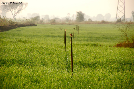
 Irrigated wheat fields in central India (photo: P. Mondal)
Agricultural adaptation strategies for future climate scenarios
This interdisciplinary project involves the spatial science community and the crop-climate modeling community within Columbia University, New York University, and governmental and non-governmental institutes in India. In this project, we are combining field and simulation data to (a) estimate crop productivity at field-level for winter crops in central India for near-term (2015-2020), mid-century (2050s), and end-of-century (2100s) scenarios and (b) identify how crop productivity will vary with different adaptation strategies for projected climate change scenarios. This project is funded through Lamont Climate Center and NYU Global Health Research Challenge Fund.
This interdisciplinary project involves the spatial science community and the crop-climate modeling community within Columbia University, New York University, and governmental and non-governmental institutes in India. In this project, we are combining field and simulation data to (a) estimate crop productivity at field-level for winter crops in central India for near-term (2015-2020), mid-century (2050s), and end-of-century (2100s) scenarios and (b) identify how crop productivity will vary with different adaptation strategies for projected climate change scenarios. This project is funded through Lamont Climate Center and NYU Global Health Research Challenge Fund.
|
Private forest, housing pressure, and alternate scenarios
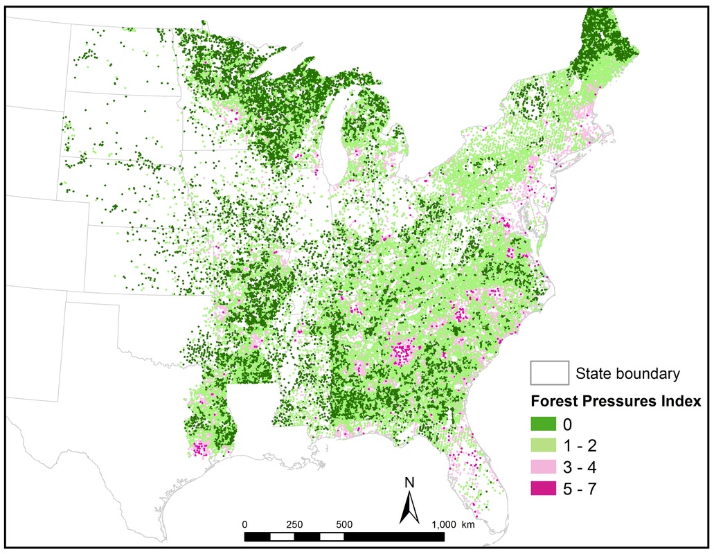
This project examined spatial characteristics of forest and forest ownership attributes across urban-rural gradients in the United States. The project was funded through the Northern Forest Futures Project (Northern Research Station, USDA Forest Service) and examined how current forestry trends and management choices can change the future landscape of the Northeast and Midwest US. This work developed a spatial index (Forest Pressures Index or FPI) that provides a glimpse of the future of private forests in the US - not only where, but how these forests might be under pressure during next 50 years. |
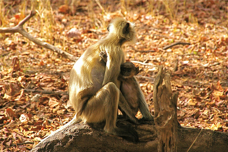
 Golden Langurs in Pench Tiger Reserve, India (photo: P. Mondal)
Protected area and forest cover change
This project addressed issues related to land-cover/land-use change, biodiversity conservation, forest management strategies, and national level policies in India. Dr. Mondal created discrete land cover maps (generated from multiple satellite platforms such as Landsat and ASTER), spatial models (Cellular-automata Markov model), and surface gradient models (using vegetation indices) to simultaneously quantify spatial and temporal changes in this area, and to evaluate the effects of national-level policies at a regional scale. This research was funded through UF Alumni Fellowship and UF Tropical Conservation and Development Field Research Grant.
This project addressed issues related to land-cover/land-use change, biodiversity conservation, forest management strategies, and national level policies in India. Dr. Mondal created discrete land cover maps (generated from multiple satellite platforms such as Landsat and ASTER), spatial models (Cellular-automata Markov model), and surface gradient models (using vegetation indices) to simultaneously quantify spatial and temporal changes in this area, and to evaluate the effects of national-level policies at a regional scale. This research was funded through UF Alumni Fellowship and UF Tropical Conservation and Development Field Research Grant.
